


The April 8 total solar eclipse, with its path crossing through parts of Indiana and Kentucky, is days away, and new research suggests fewer Kentuckians could experience totality because previous 2024 eclipse maps are wrong — though not by much.
Despite these findings, NASA told the IndyStar in an email that its predictions for the eclipse have not changed — and, added Butler University Physics & Astronomy professor Brian Murphy, the new map won’t make a huge difference for the millions of Hoosiers watching the eclipse.
“The path of totality might have narrowed, maybe by a mile total, but we’re talking about going from 115 miles to 114 miles wide,” Murphy said. “If you’re near the edge of that path, go a few miles further into the center at the very least to ensure you see the totality.”
Total Solar Eclipse Viewing: In 2017, former President Trump showed exactly what not to do during a total solar eclipse
When is the next total solar eclipse? Path of totality set for April 8
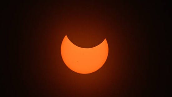
A total eclipse of the sun is set to appear in the skies April 8, beginning in Texas at 1:27 pm CDT and ending in Maine at 3:35 pm EDT. The last solar eclipse visible over the U.S. was in 2017, and it won’t occur in such an accessible fashion again until 2024.
Newsworthy
Here’s what we know about the new eclipse path and why it matters:
Did the 2024 total solar eclipse path change?
Several media reports Tuesday and Wednesday called into question the forecast for the 2024 solar eclipse path, or where the moon’s shadow will pass over the Earth when the moon partially blocks out the Sun. The projected path might be off by as much as a mile, according to John Irwin.
Irwin, who calculates solar eclipse data for the blog site Besselian Elements, released a newly updated forecast for the eclipse path. As first reported by Forbes, Irwin’s findings show hundreds of towns and cities across Mexico, North America, and Canada have lost their solar eclipse.
Kentucky cities affected by Irwin’s findings include Louisville, with totality nearly a half mile further away on the redrawn map. This means area residents will no longer find totality in Vienna, Indiana, located about 30 miles north of downtown. However, those in Henderson, Morganfield and Paducah will still be able to see the totality from the comfort of their homes.
Why did the eclipse map change?
The map changed because of how Irwin and others have calculated the size of the Sun, which might be slightly larger than what scientists thought.
Alex Young of NASA’s Goddard Spaceflight Center recently told Astronomy publication EarthSky that he and other researchers spotted differences between the actual and predicted path of the total solar eclipse that crossed North America in 2017, prompting a change in creating a new eclipse map for 2024.
The updated solar eclipse map by Irwin and Besselian Elements, according to Forbes, factors in the exact topography of both the moon and the Earth to create “a more accurate eclipse map” using new information about the Sun.
How accurate is the new eclipse map?
The members of Besselian Elements on their official Facebook page describe themselves as “a team of dedicated amateur astronomers, passionate about solar eclipses.” Their findings, according to a recent article on Space.com, have yet to be peer-reviewed, so take them with a grain of salt.
What does this mean for Kentucky?
NASA told the IndyStar the new eclipse map will affect cities on the very edge of the path of totality, where predicting how long the eclipse will last is difficult no matter what. A difference of a few city blocks one way or the other, NASA said, could mean 20, 10, or 0 seconds of totality.
Experts are urging people living along the edge of the eclipse path to play it safe if they want to watch the total eclipse by moving closer to the center of the totality.
“Don’t stay right at the edge,” Murphy said. “Get a few miles in to guarantee at least 10 to 30 seconds of the totality.”
Solar eclipse map: Updated path of totality for Kentucky
How to interpret the updated 2024 solar eclipse map
The yellow line on the map is the center of the totality. The red line is the original eclipse path while the three orange lines, according to Irwin, show the outer limits of where viewers can expect to find 100% darkness. Those wanting to experience that 100% darkness should view the eclipse from somewhere within the innermost orange lines.


